Lost, Found and Place Names
I have hiked in the California Sierras every year in this millenium. Many of the places are un-named. I have given some of them 'unofficial' names to help in the descriptions. I have lost some stuff: two sleeping bags and one tent. But I have also come across lots of interesting stuff. Let me share some place names and how they relate to my lost and found.
- Winchester 1886 Rifle
- Timex Expedition Watch
- Tom's Tumbler, Natural Rock Polishing
- Tents: One Lost, One Found
- Sea Gull Island
- Lookout Tower
- Spindle Lake
- Oops Pass
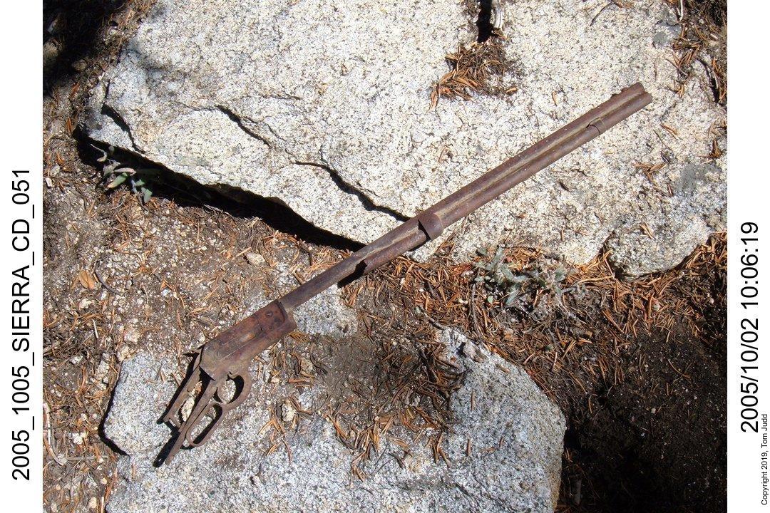
Winchester 1886 Rifle
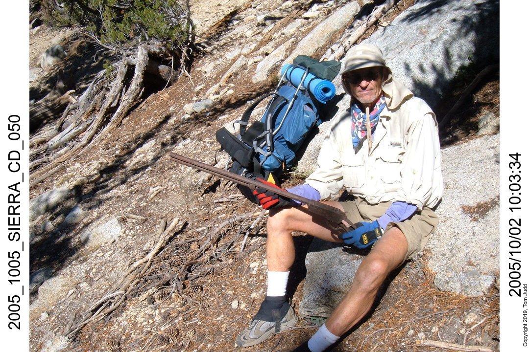
I think the most interesting piece of hardware we discovered was the remains of a rifle. It was quite by accident.
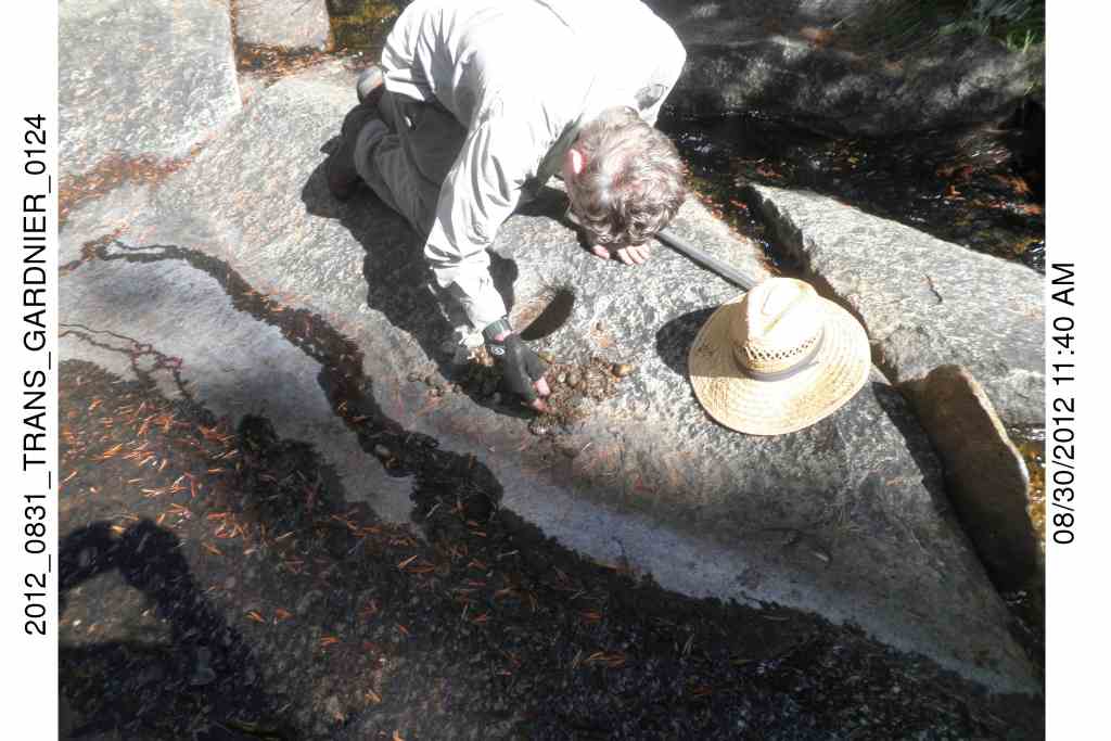
In late September 2005 Dale and I started out on an off-trail adventure that was to go over Gardiner Pass. We started from our camp below the pass at about 9:00 on Oct 2. Dale was always ahead of me . We found some trails, but mostly made our own. We took our time. About 10:00 I heard Dale banging on something. It occurred to me that he must have found something, because I couldn't think of anything he had that would make such a noise. When I got up there I could see that he found an old rusty rifle; he was banging it against rocks and trees to get all the dirt off of it.
Dale had paused at a rock to sit down and wait for me. He dug his heel into the sand in front of him to gain some support against the steep slope. He hit something. Working at it for a bit he uncovered the ancient firearm. It was heavy! All the wood had decayed away, and half the magazine was gone too. Even so, it weighed about ten pounds. One could see the remainder of a cartridge stuck in it. Later, Dale sifted the sand beneath the site and found the lead end of a bullet. The casing had mostly disintegrated.
The serial number is unreadable, but at the top of the muzzle one can make out '45##7#'. This suggests that the rifle used 45-70 rounds. That's a big bullet!
What a mystery! Who lost it and when? Why the big round, why going up the pass? How could someone lose such a valuable piece of equipment? Think about it and let me know if you have an answer.
Timex Expedition Watch
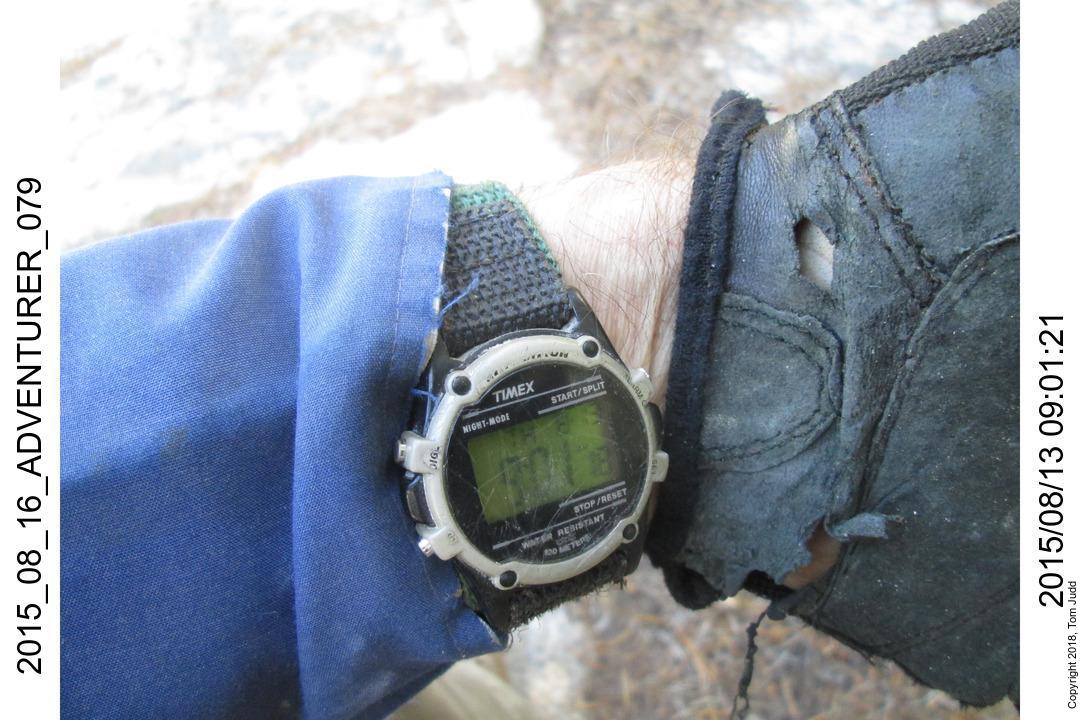
In September 2002 Dale and I set out on the Sierra High Route (SHR) starting at the Copper Creek trail near Cedar Grove. Although well known, the route is mostly off-trail, so not as many hikers use it. We saw no one for six days. We left the SHR over Cartridge Pass and completed our loop down Muro Blanco and Paradise Valley.
We were descending Gray Pass on our fourth day when Dale called out that he had found something of interest. It was the watch. Still ticking. The cloth watchband had been torn. I don't recall if the time/date was correct. Dale didn't want it so I kept it as a souvenir. A few years later my watch broke, so I put a new battery into the Timex and have been wearing it ever since.
You may notice in the picture that the face has become scratched. It is a testament to the many backcountry bushwacking trips I have taken in the Sierras.
Tom's Tumbler
Natural Stream-driven Rock Polisher
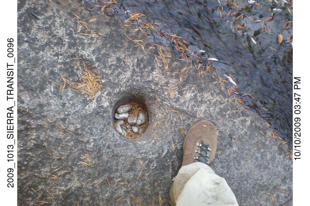
There are a couple of drainages on Woods Creek that I have climbed. One across from Castle Domes leads up to King Col. The next one over to the west is steeper and harder. It starts about 1.5 miles (2.5km) above the junction with Arrow Creek. Dale and I climbed this one in October 2009.
At the lip of the climb I found the curious post-hole shown in the picture. It looked so uniform that at first I thought it was man-made. But that didn't seem reasonable. What's the purpose? I then guessed that it was a naturally occurring hole that had been tumbling and polishing rocks for the last 10,000 years (since the last ice age). The water rushing by the hole in the spring stirs the pot so that the rocks tumble against eachother and the sides of the hole. It is interesting to speculate how long it takes to round off the corners of a rock and what the turnover rate is.
Tents: One Lost, One Found
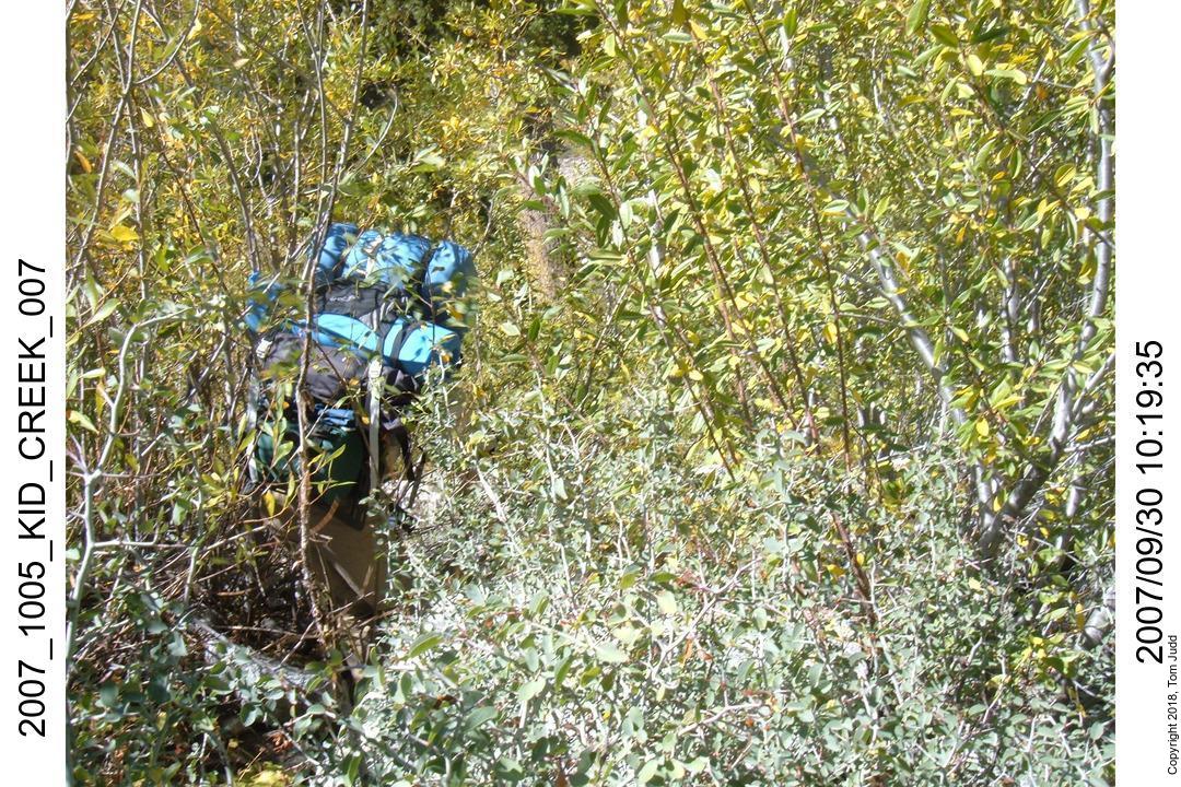
In late September 2007 Dale and I set out on a back country loop that began up Paradise Valley and got rough beating our way up Muro Blanco. Somewhere along the way our tent was ripped from its lashings on Dale's backpack. The tent was lost. It was a new tent I had received the previous Christmas from Marin. Dale and I slept in it once in Paradise Valley.
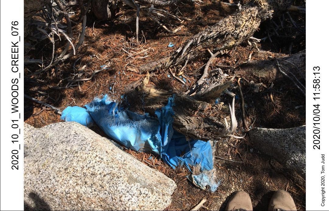
Earlier in July of the same year I found a tent. It was a simple rugged pup tent; I had purchased a similar one 20 years before at K-Mart. It was wedged half-buried up against a juniper near the peak of a mountain across the valley from Mt. Clarence King. I again visited the site in Oct 2020. Compared to my own pup tent I guessed it was made in 1980 to 1985. I wonder who lost it?
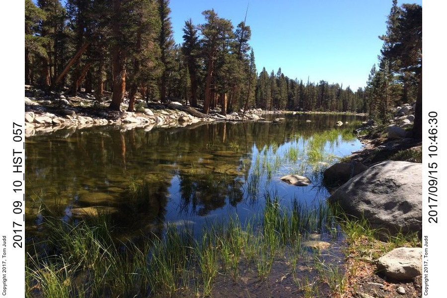
Sea Gull Island
I noticed this first around 1992 and then thought I would want to visit it. I finally did in 2016.
Spindle Lake
This lake is in the shape of a symmetric sewing spindle, tapered at both ends. During very dry years the lake contracts considerably. See Negotiating Chagoopa Plateau for a map.
Lookout Tower, Lookout Creek
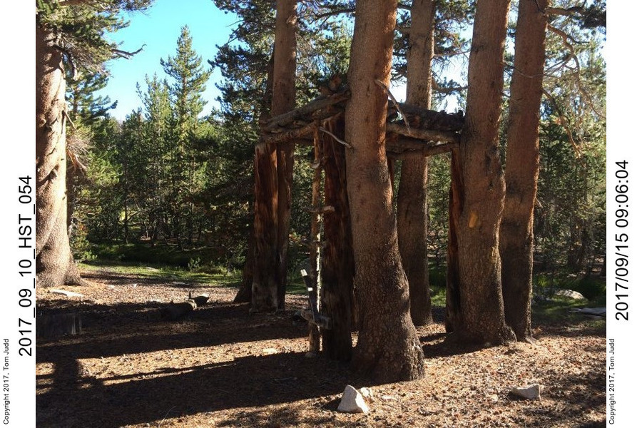
Tower discovered on 2015 trip to Kaweah basin. See Negotiating Chagoopa Plateau for a map.
Oops Pass
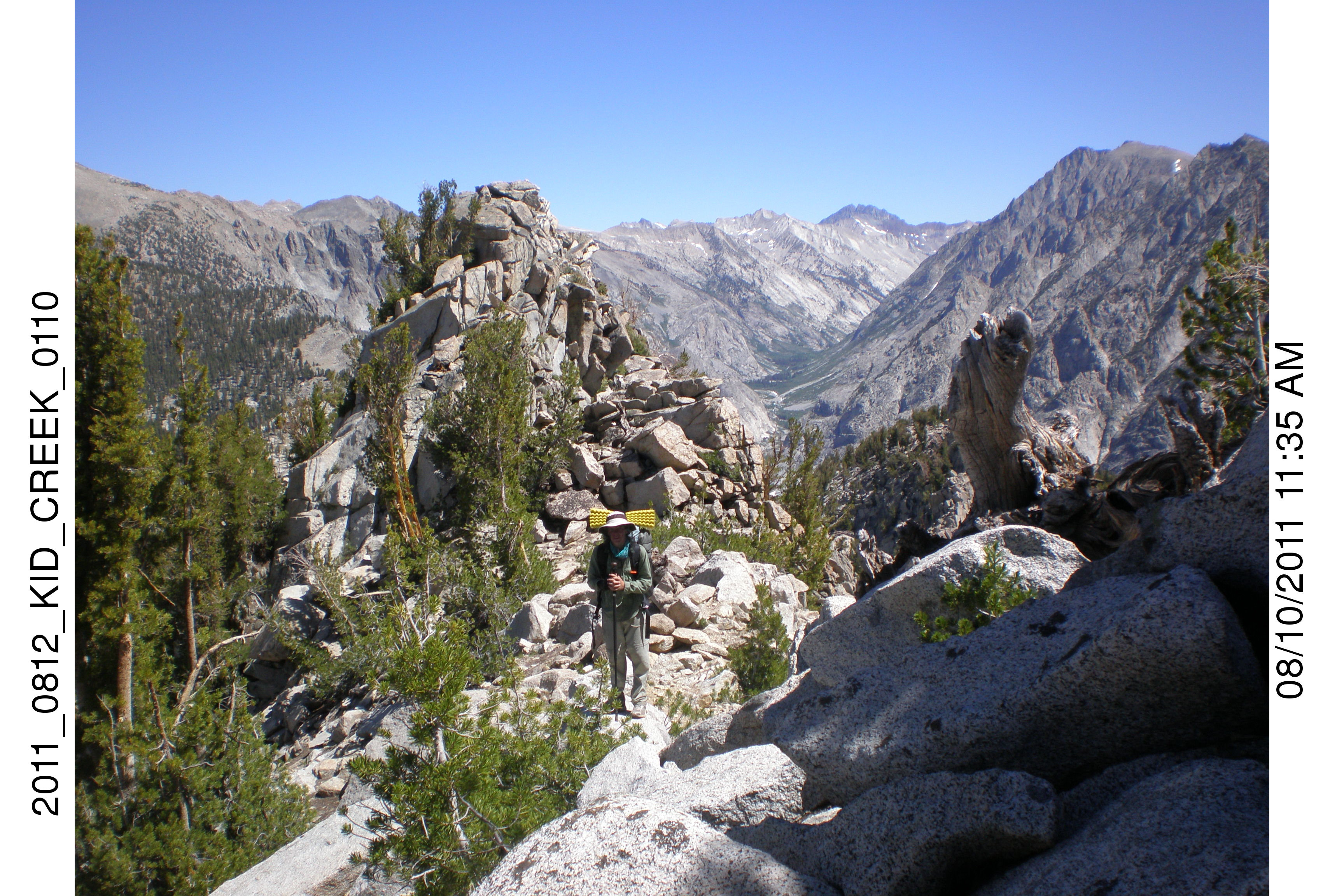
In 2007 Dale and I climbed up what we thought was Kid Creek from Muro Blanco. Instead we climbed the drainage that was exactly 1 km south. I was using UTM on my GPS, which reports positions in meters. I failed to notice the discrepancy. I didn't realize my error until I got to the pass. OOPS!
The climb up is quite strenuous. Going down is easier but still scary because of the steep slope. I went down in 2011 with Marin and Jon, and in 2012 with Wally.
©2020 Tom Judd.
www.juddzone.com
Carlsbad, CA
USA