Four Sierra Hikes in 2020
Bishop Pass, Copper Creek, High Sierra Trail, and Woods Creek
Intro
There were a couple of reasons that made it important to get out and hike this year.
- I am getting older; I would like to hike while I still can
- Family is also requiring more attention while it ages. I would like to hike while I still have the time
- I broke my ankle at the start of 2019's hiking season. I wanted to confirm that it had healed. Lost time is precious at my age. I also wanted to make up for lost time.
But events seemed to frustrate my intentions:
- The COVID epidemic shut down access to my hiking areas: Sequoia, Kings, and Inyo National Parks
- California wildfires shut down access to parts of the Sierras
- Due to COVID distancing recommendations, hiking permits had to be serviced over the phone, no walk-ups. The sudden surge overwhelmed the National Park phone system.
Four Sierra Hikes in 2020
August 2020 Copper Creek
Sept 2020 High Sierra Trail
Oct 2020 Woods Creek
Bishop Pass with Wally
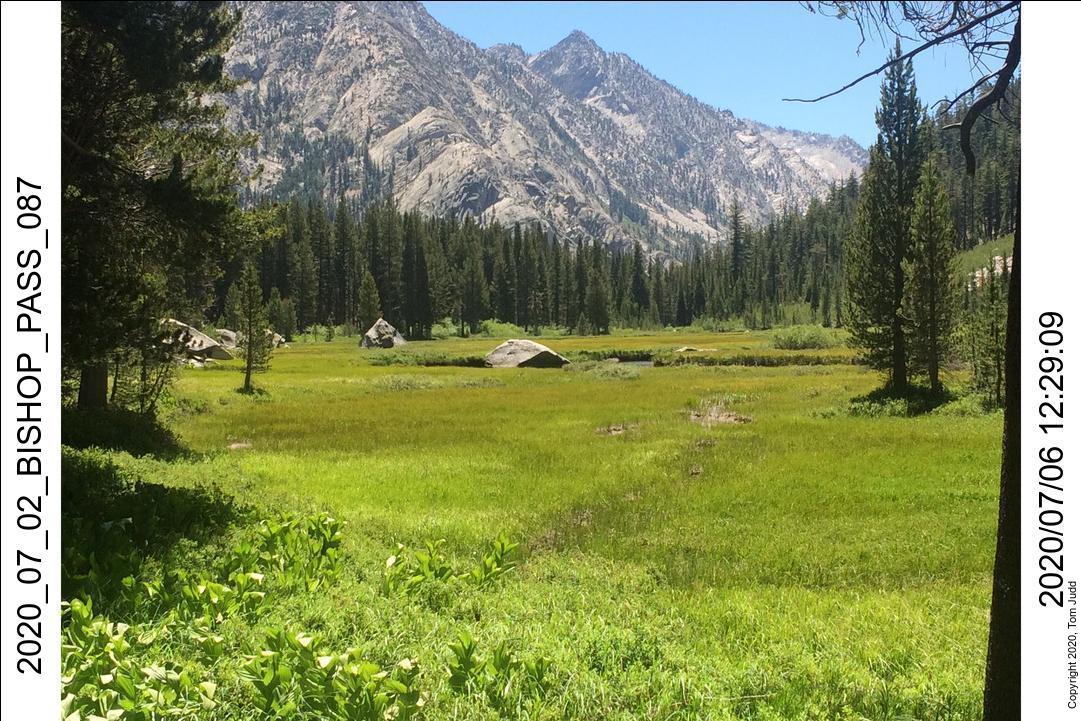
1-July to 3-July 2020
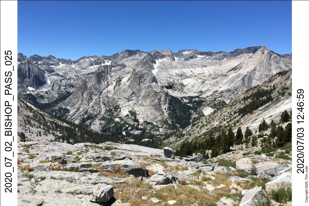
This was an important first hike after my broken ankle. My exercises before the trip did not uncover any problems; but this would be the first extended test. Arrangements for this trip were difficult because of the COVID scare. Lots of busy phone lines. In addition, they were doing construction on the road up to the trailhead. Parking was limited. I arrived early on the first and scouted our campsite at Baker Creek, and the road construction.
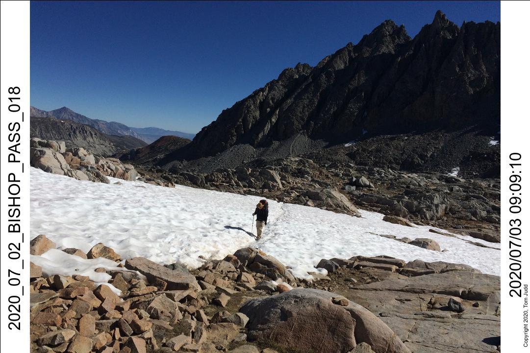
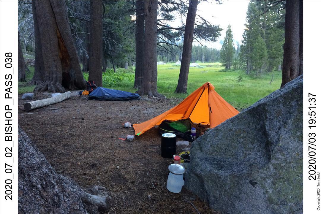
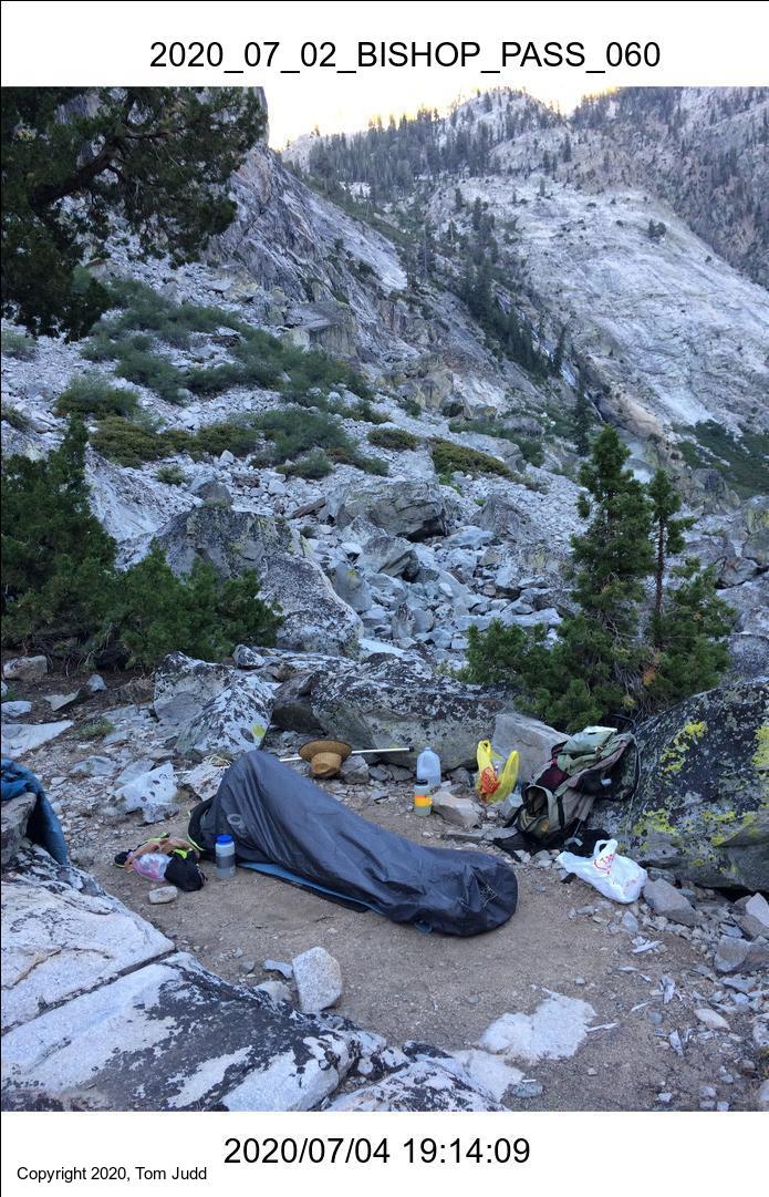
The next day, July 2, Wally and I started off at about 10AM. I had to park down by the Willows campground and hike up to the trailhead (2 miles?). We made it up to about 11.2K feet near Bishop Lake before we called it quits. We were both quite tired. Next day, July 3, we made it up and over the pass and then all the way down to Grouse Meadow. At this point I noticed some soreness in my ankle. It underwent serious pounding from a 7000 foot descent while carrying a 45 pound backpack. But, it recovered overnight. I noticed some residual soreness while hiking the next day, July 4. But that was the last of it for the rest of the summer!
4-July to 8-July 2020
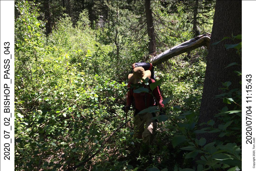
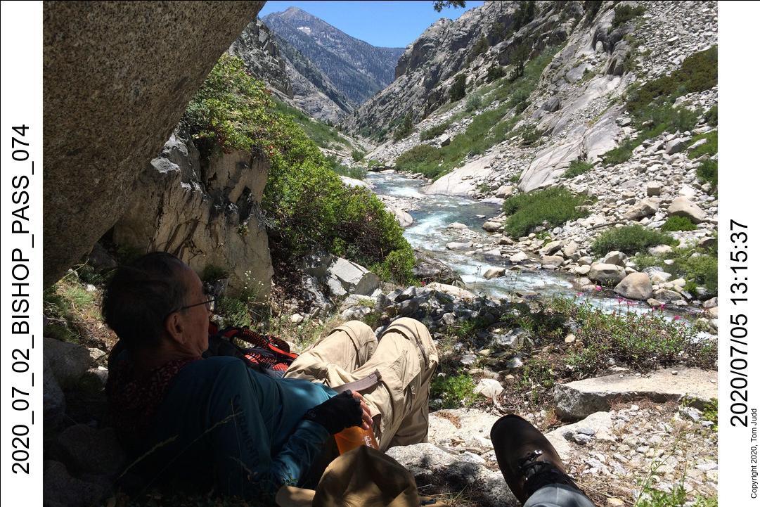
We needed to cross over Palisade Creek, but it was too high for my comfort. We went on up a mile to the logs I had used two years before and crossed there. It was a struggle to whack through the brush on the other side of the creek. Lost a hiking pole that had been tucked in my backpack. Once back at the junction we went south about two miles to a campsite near Observation Creek. The trail was so overgrown that brush completely blocked the trail in places.
On July 5 we started up Observation Creek, but fairly quickly decided it was beyond the scope of the current hike. No problem; we just whacked our way back up the overgrown trail to the junction for the night.
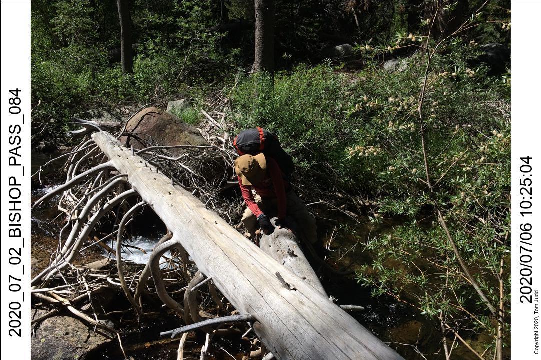
On the sixth we tested the crossing to get back onto the JMT. Still too iffy. So we bushwacked up the creek. We lucked out in finding a closer log bridge to cross. This one had an island in the middle. We camped the night near the bridge just before the trail up to Dusy Basin.
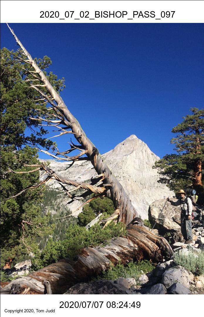
July 7 found us starting back up the trail to Bishop Pass. We made it up to a small lake near 11.5K feet, and the next day made it back over Bishop pass. One of the road construction crew gave us a ride back down to our cars. Wally and I split up at that point. I went on down to the rest area to clean up, Independence for gas, and Lone Pine for hamburgers. Took about five hours from Lone Pine to get home at 8:20 PM.
I was very very pleased with the performance of my ankle on this trip. I would say that I have recovered fully. Thank you Dr. Garrett Tallman
Sierra High Route Loop
Copper Creek to Cartridge Pass,loop back by Bench Lake and Arrow Pass

Sierra High Route (Roper) Loop
This is a neat trip. I love it. Dale and I did a similar trip in Sept-Oct 2002. I started it last year but broke my ankle on the second day. I was more careful on this trip.
4-5 Aug 2020
I got to the trailhead early and was up at Lower Tent Meadow by 2PM. It had been a hot climb so I rested quite a while before deciding to push on. The problem was that I knew of no other campsite for the next 3000 feet of climb. I went anyway thinking that I could find a flat spot somewhere. I found a place in the 'V' of a long switchback and was prepared to spend the night there. But upon exploring across the creek I found several real campsites with fire pits. This was Upper Tent Meadow.
Got about ten hours of sleep; very ready to start off-trail today. Climbed up to the pass to Granite Lake, then started off trail to Grouse Lake. Spent some time in the cliffy areas going clockwise around the lake. I was being extra cautious, and backtracked a couple of times. I was at the broad flat area near the pass at about 1:30. This is where the helicopter landed last year.
About this time I heard someone whistling. I looked down into Granite basin and picked out a hiker coming up to the pass. When she attained the pass I met Talley V. Kayser. She was the first person I had ever encountered in twenty years of off-trail backcountry hikes. So yes, I was surprised. She teaches courses in hiking/adventure literature at Penn State. And spends her summers hiking. She was completing the Sierra High Route in reverse.
I spent some time visiting the site of last-year's broken ankle, then started off to the pass to Glacier Lakes. I was down at a campsite on Glacier Lake by about 6:30PM. I was pretty tired, hungry, and had to purify some water before dinner.
Aug 6-7 2020
I was slow to fall asleep last night. I ate late, and that made my heart beat harder as I was trying to fall asleep. My usual solution is to drink water. But, it is not as effective on a full stomach.
I was being delibertly cautious on this trip, so it made going down over cliffy areas a bit slow. So, I was slow getting off the cliffs to Glacier Valley. But it was a very nice walk through the meadow after that. I got to State Lake just after eleven, and Horseshoe Lakes at about 1:30. I was off a bit to the right going to Windy Ridge, so I needlessly climbed up aways and then had to backtrack. I did it again when looking for my campsite: the small clear lake at 11.1K feet, perched about 400 meters south of Gray Pass.
The next day it was a straightforward downhill trip along a ridge to Gray Pass. At the gulley just before the gray rock I spied a trail! Apparently, this backcountry route is getting a lot of use. I didn't see as much human evidence the last time I went this way, eighteen years ago. I followed it half way down then hopped out onto the flat rock when it got too bushy. From there it was a steady uphill to White Pass. Got there about noon. Since I had started about 7, that made it about five hours from pass to pass.
Getting down from the pass was harder than I remembered. I had to remove my pack twice to negotiate some steep rocky sections. At about 3 PM I was at Red Pass. But wait! This isn't the pass! I had looked at the miniature topo map I had carried and it indicated the first dip down was the pass. But it wasn't. I didn't realize it until I had climbed up an extra 350 feet, almost to 12K feet altitude. It was slow going and a lot of work at that altitude. I pulled out my iPhone with the inReach Maps and saw my mistake. Grrr!
After the real Red Pass there were a lot of use-trails to follow. It seemed like a long time to get down. Eventually the deep blue Marion Lake appeared amongst the peaks. I followed the valley down towards the lake until I got to the 'Impossible' chute. It is horrifingly steep, and looks impossible at first glance. But, I had been down it before, so I knew it was doable. I started picking my way down with my eyes. I could see that while steep and scary, there was a logical and safe way down. When I started, I accidently kicked a rock loose. The sieres of crashes it made while tumbling down was dramatic. Be careful if you are hiking with a partner.
It took a patient half hour to get down. At the bottom there was a somewhat of a trail following the lake. There were some annoying ups and downs, but I finally made it to a campsite by the lake just before 6 PM.
Aug 8 2020
The hike from Marion Lake to the foot of Cartridge Pass is really pleasant. I started about 7:40 from Lake Marion and was up at the pass at about 1:00 PM. There is a trail down but It is easy to lose in some areas. I went clockwise around the last lake. There was more up and down along the rim of the lake than I would have liked. At about 3 PM I started the steep descent into Muro Blanco. Some trail; but it vanished into a big brushy area about half way down. Circled to the left and eventually got down to the river before 5PM. It was really tiring.
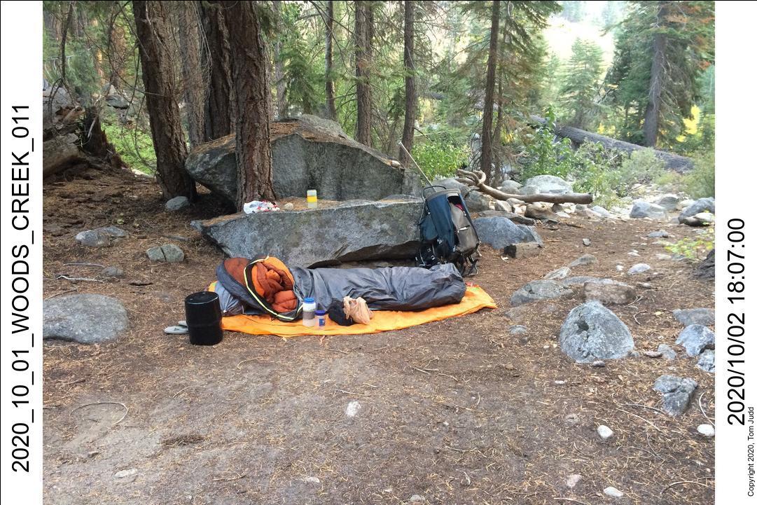
My cooking style has changed in the last 5 years. I am not carrying a pot or lid. I heat water in a large IMUSA aluminum cup (1.3 liter). My no-cook food can be eaten cold, but I often heat it anyway. A cup of water will boil with 4 grams of fuel. Hot coffee or warm food needs heating to only 50-60 degrees C, so I usually do not waste fuel on boiling. I switched to a cheap $10 burner that has a piezo spark starter. The dry food goes into a small plastic jar (red lid in the picture). I then add hot or cold water and shake it up. Let it set for a minute and it is ready. The plastic bag on the right holds the Sawyer water filter and squeeze bag. I still carry a water jug (2 oz) for convenience. The bear barrel is behind the cup. Looking closely you may see a Hershey chocolate bar in the background. I have been using these lately instead of butter for my high-fat food. Not as many calories per gram, but it is a lot more convenient.
Aug 9-10 2020
The hike up to meet the John Muir Trail was harder than I expected. It was hard to find the trail. Hiking with a buddy would have really helped. We could spread out and search to pick up the trail. One good thing I noticed was that the topo map shows the trail crossing the creek in the correct place. So putting a GPS waypoint there would help when navigating the next time.
I made it up to the far end of Bench Lake and picked out my campsite by 2:30. The wind off the lake was annoying, so I put up my tent behind a big rock. Unfortunately, the campsite was running wild with large sierra black ants. I had to be careful when getting in/out of my bivy or I would get some uninvited company inside. When laying down to sleep, the ants were very noisy burrowing next to my ear underneath my bivy. I finally got some DEET and sprayed the largest concentration. That quieted them down.
The next day I got into a bit of trouble trying to take shortcuts. The hike up to the lake below Arrow pass was OK. But it was a big loop clockwise around the lake. I tried counter-clockwise. I started climbing up and realized it was getting too steep and too dangerous. I was ready to bail and take the JMT. But I got down and tried another shortcut across the lake. Nope. I had to go all the way around.
Here I met a pair of hikers. Christy Rosander and friend were coming up from the south after just covering one of the horribly difficult passes (Whitefork Pass?). For the second time this trip I met someone out in the boonies. The chat was a nice break.
The way to Arrow pass was pretty clear once you get around the lake. Just follow the hump with all the trees up. It becomes all boulders about 2/3 the way up. I took the lower of the two passes. I was up there at about 1:30. Coming down I took a large loop to the right. I got down to lake level at about 3 PM. The sky was clouding up and I could hear thunder in the distance. So, I started looking for a flat spot with water. The tent was up at about 5 just as it started sprinkling. It wasn't a serious rain, but it was with a sense of accomplishment that I listened to the light pattering on the tent which I had designed and sewn together.
Aug 11-13 2020
This turned out to be one of the more troublesome hiking days. Except for the section over Arrow pass, I had hiked over all of the backcountry portions before. I was never lost, but I couldn't always hit on the best route through the jumbled rocks and cliffs. A hiking buddy would have made that part easier.
The first part of the day was very nice. I hiked down Arrow creek, then went over the hump to the Window creek drainage. I was at the lip of the cliff leading down to Woods creek about noon. I ran into trouble getting down the 1800 foot (550m) drop. I ran into several large flat steep impassable slabs of granite. So, I had to backtrack UP the hill a couple of times. I had just been up and down this way in 2016, and recognized many of the landmarks. I tried left, then center before I finally got down going to the right. When I finally figgured it out I took a shortcut on a ledge across one of those slick slabs. It really was safe, but I am afraid of heights. I didn't reach the trail until 5:30!
Rattlesnake!
I took about ten steps once I reached the trail when I was startled by a rattlesnake. It was huge, within a hiking pole's length away to the side. It reared up in classic rattler pose with its tail shaking behind a head that was looking directly at me. I couldn't back up, so I softly slid to the side down the trail. When I got far enough down I turned around in time to see it crossing the trail. Its head was already hidden in the brush on one side while its tail was still lost in the shrubs on the other. It was big!. 'Twas gone before I could break out my camera. I thought it ironic that the hiking danger that I was least worried about gave me the biggest scare.
About a quarter mile down the hill I spied a campsite down a steep rock rubble near the river. There was no trail to it; but it was spacious and comfortable.
It was a warm night, overnight low was 61 degrees F. I started about 7 AM the next morning and was at the car at 2:40. I was slowed by a bear that was wandering down the trail just ahead of me. I stayed overnight in Tulare. Got my favorite after-hike meal at Apple Annies and ate it during a family Zoom meeting.
Got home about 1PM the next day. I was down about four pounds in ten days. It was a very satisfying trip.
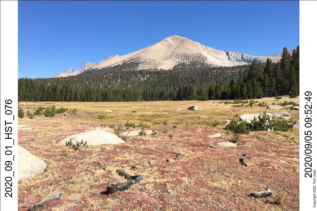
High Sierra Trail
To Big Arroyo with Marin then solo to Chagoopa Plateau
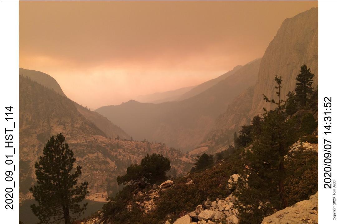
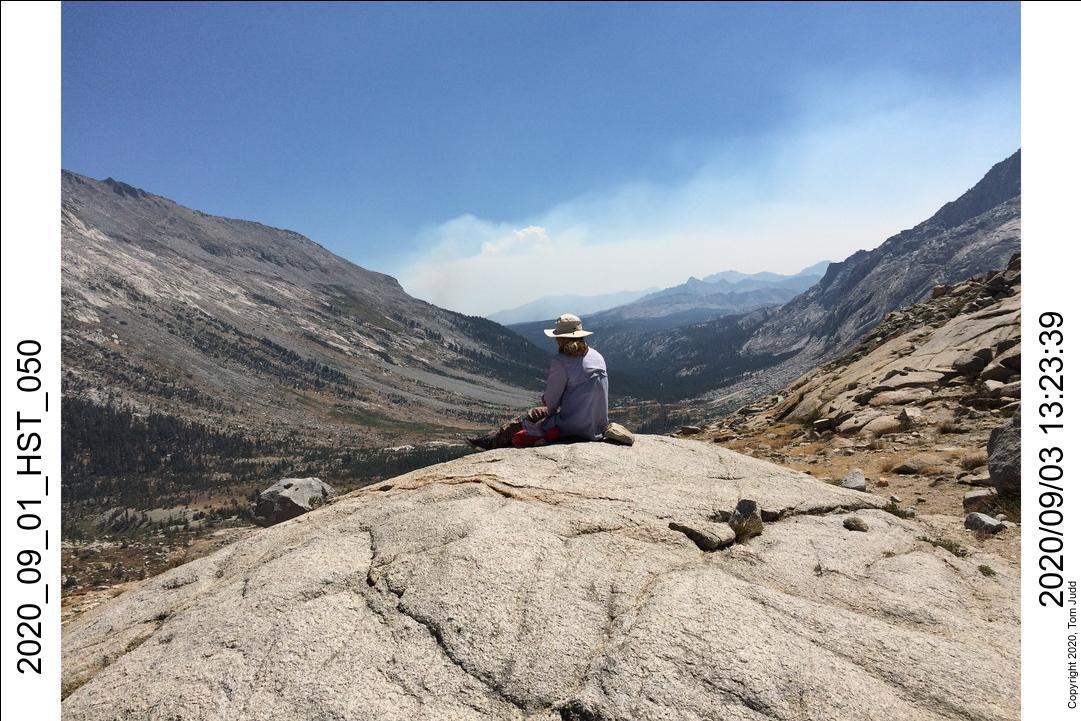
Heavy smoke from fires forced a hasty exit
Sept 2020
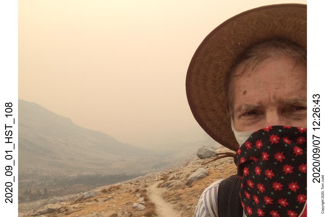
High Sierra Trail Sept 1-2
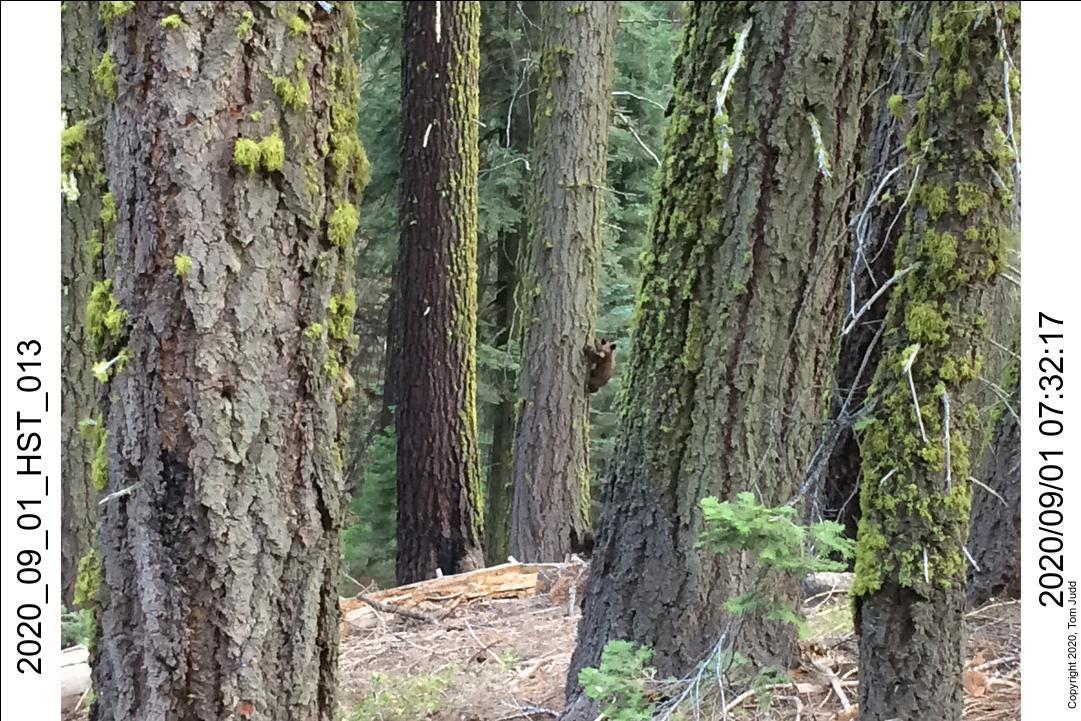
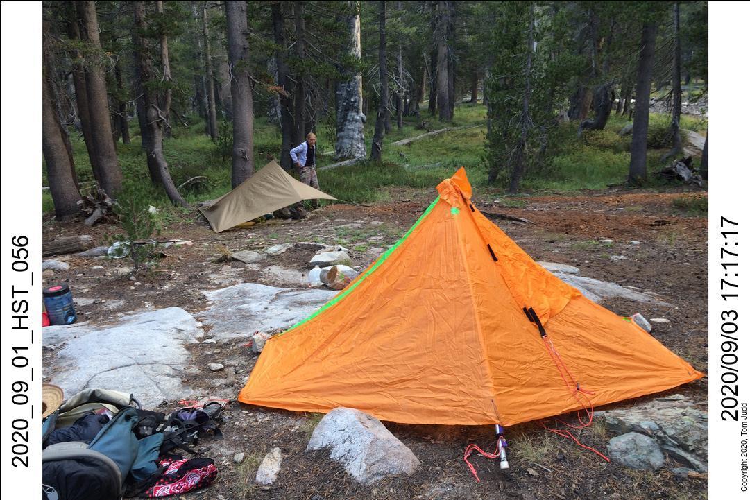
I lucked out and got a campsite at Lodgepole. There was high demand because COVID inspired vacationers to drive instead of fly. Marin met me there and we got an early start on the trail. But after an hour of hiking I discovered I had forgotten my sleeping bag! That shifted our schedule. Because of the fire scare, only three persons started on the HST that day. Delightful were the bear cubs we saw clambering up a tree as we walked by. We made it to Nine-mile creek for the first night and Hamilton Lake for the second night.
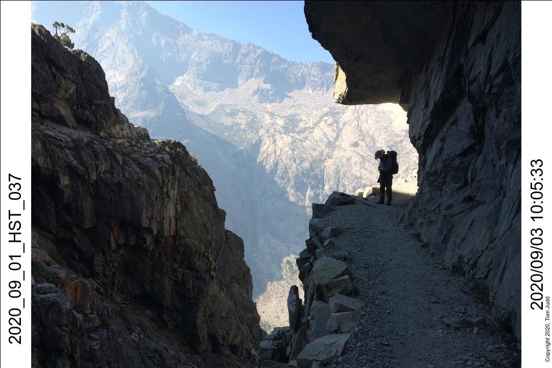
Sept 3, HST
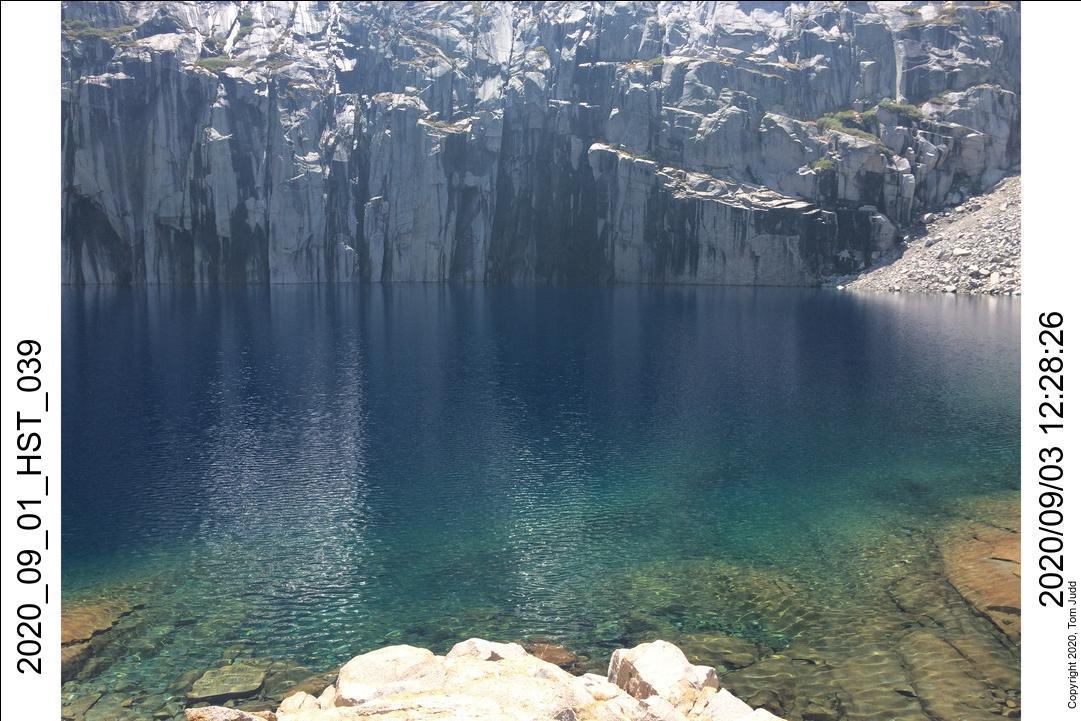
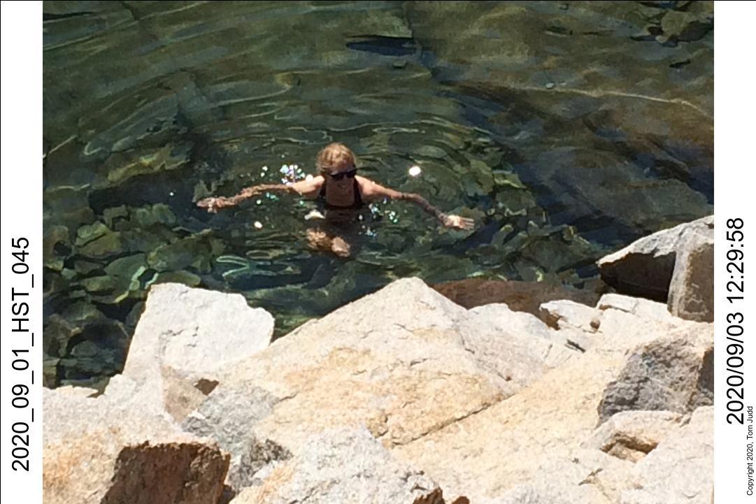
It took about five hours to get up to Kaweah Gap from Hamilton lake. Precipice Lake was very beautiful. The colors shine best on a sunny day late in the hiking season when the ice has all melted. We stopped for a bit so Marin could splash in Precipice Lake.
Sept 3 continued, HST
The haze from the fires cleared up once we got over the pass. You could see the smoke from the Rattlesnake fire in the distance, but we were not going that far. Down at the campsites in Big Arroyo we found a nice secluded place next to a meadow where deer came out in the evening. The problem was the national park trail crew. They had a mule with a cow bell that rung all night as it wandered freely up and down the campsites. Grrr!
Sept 4, HST
The next day we took a day hike up towards the Little Five Lakes. It was nice; I had not been on that trail before. We had smores by the campfire that night.
Sept 5, HST
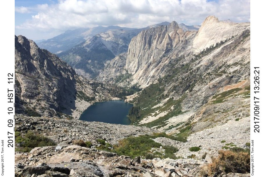
Marin had to get back to work so we parted this morning. I continued on to the Chagoopa Plateau. I had made the same trip in 2017. I started off trail at my usual place and passed the Lookout Tower and Spindle Lake before getting to Red Spur creek, where I camped for the night. There were quite a few broken trees. An avalanche had swept through the area since the last time I had been here.
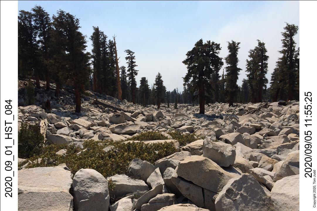
Sept 6, HST
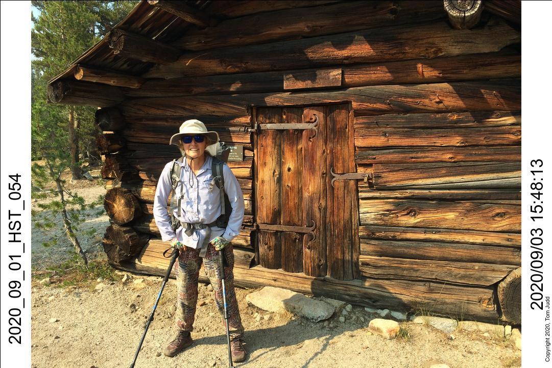
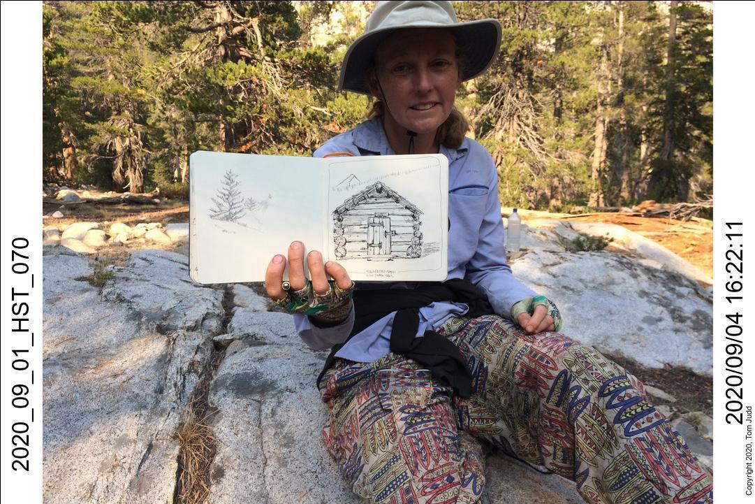
I had originally intended to climb up and over the Red Spur. But after three hours of climbing I saw that I was not reaching my goals. So rather than risking some night time descent over boulders I turned around. Nevertheless, I was able to clearly see the origins of the Rattlesnake fire directly to the south. I made it back to the Lookout Tower for my evening campsite. As it was getting dark I heard the wild and plaintive yelping of a coyote. It sounded like it was getting attacked and losing. Now, that was scary. I didnt want to be in the same situation as the coyote, so I moved my sleeping quarters, and all my gear, up 12 feet off the ground to the Lookout Tower. Now I could sleep easily.
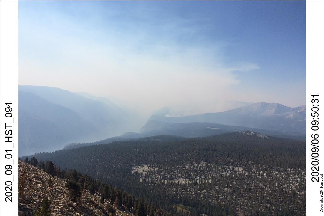
ESCAPE!
7-8 Sept 2020
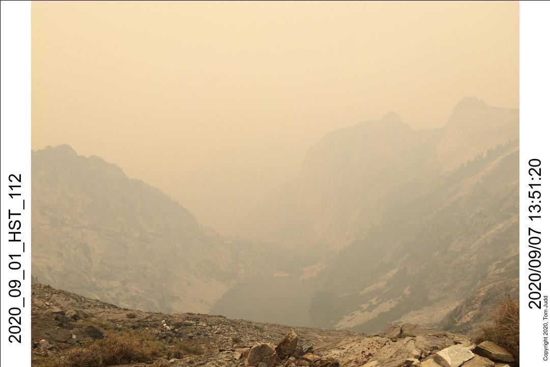
I woke up at midnight. The haze was so thick that I couldn't see the trees. My flashlight made a white cone in the dense smoke. I thought 'this is not good.' I spent the next hour pulling all my gear back down to the ground and readied myself for a quick escape once it got light.
I was up at the barely-light. Started out at about 6:30, was at Kaweah Gap in six hours and at Bearpaw at 6:30 PM. I was the only one in the campground. They had closed the park, so no more hikers had started out that day. Next day I got to my car about 1 PM. I drove out of the park and stopped in Tulare for gas and a hamburger. Home by 8:30 PM
Woods Creek and up Kings Col Drainage
Oct 2020
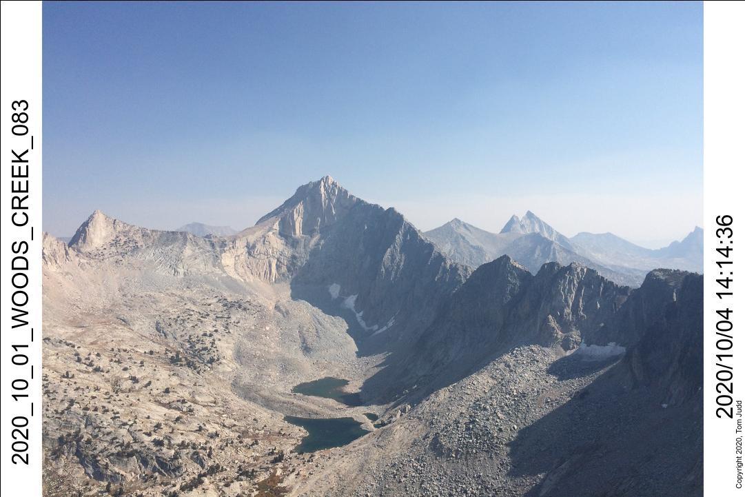
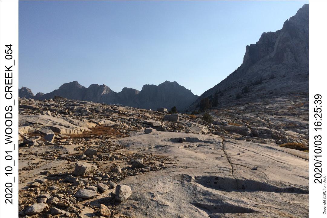
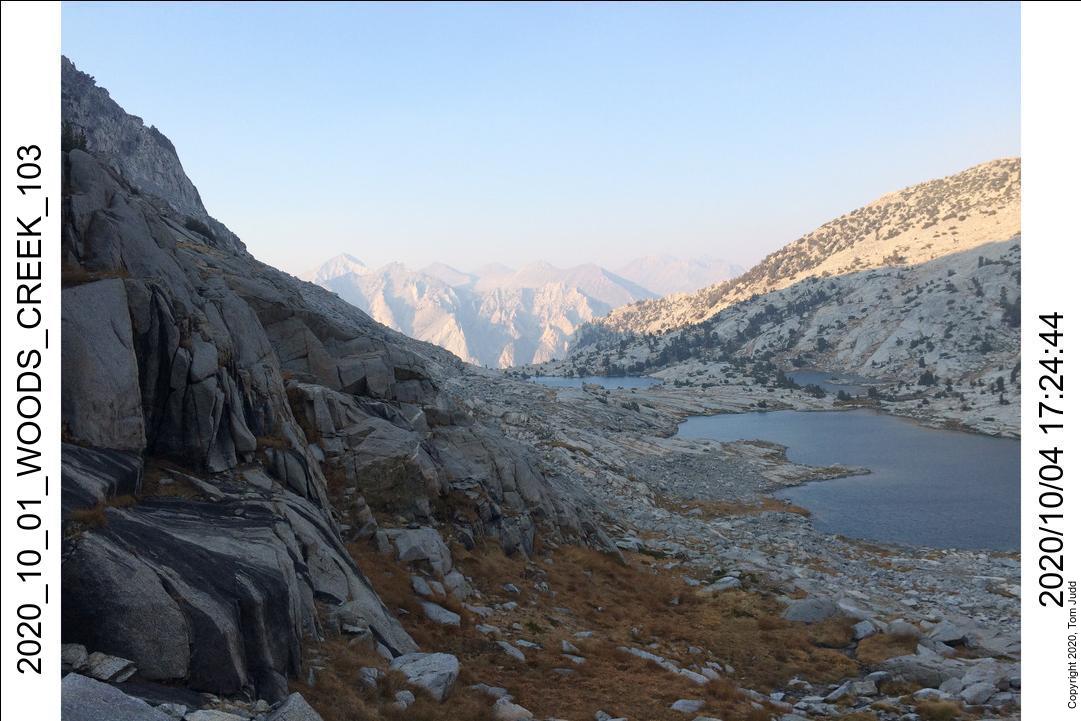
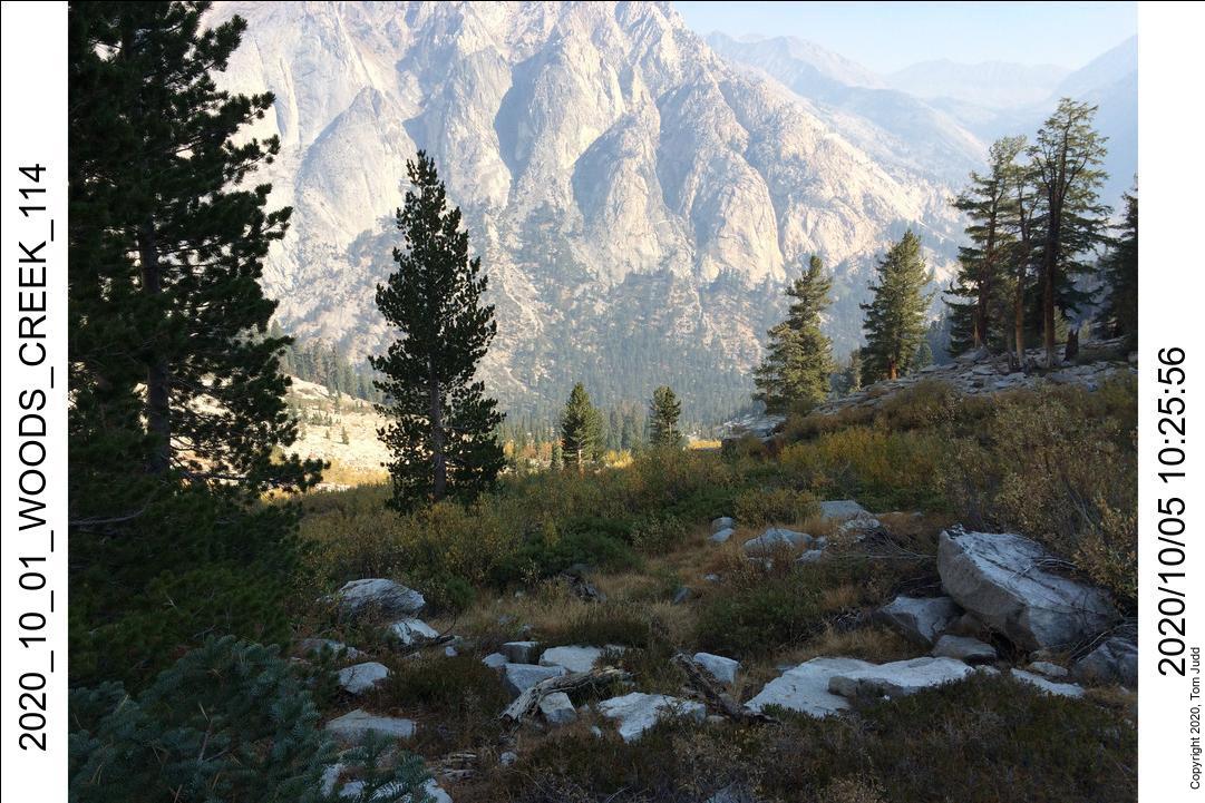
I originally wanted to include this trip at the end of my August trip. But I ran into delays and so thought I could do it in October instead. So I did. I had previously gone up the drainage solo in 2007, and down it with Dale in 2009. The peak (11.8 K feet) across from Mt. Clarence King affords one of the more dramatic views in the Sierras. And it is easier to get to than some of the others (e.g. Mt. Whitney). The panoramas below were taken on this trip and on the one in 2007.
I was floored by the view the first time I saw it in 2007 (left). The crisp edges of nearby mountains were nearly touchable. It is a classic southern Sierra view. It includes the peaks named after the four explorers (right) who first made their way through these pinnacles in 1864.
Oct 1-2, 2020
I was fortunate to get a campsite near Grant Grove. They had just opened the Azalia campground after the fires, first-come, first-serve. I left home at about 7AM and was up at Apple Annies in Tulare at 11:30 getting my favorite hiking dinner. Park enterance at 1PM. Most of the campground was shut off, only about 20 sites were available. I picked a nice one near the back and spent the rest of the day exploring and hiking around.
I got a great sleep and snuck out of the campsite by 6AM. After the drive to the trailhead and packing up I got on the trail at 8AM. I passed through all the familiar places. At Lower Paradise campsites I saw lots of campers, even though it was closed. Left Upper Paradise campsite at 3 and got to the campsite that Wally and I had used in 2016 at 4:15.
I did an inventory of my food. I did something different on this hike. I usually fill one bag with one day's food. This time I used two days per bag. It worked out ok and saved a little room. It meant I had to alternate four different grains: Oat, Rice, Ramen (wheat), and tortilla chips (corn). It worked out just fine. The rice had been somewhat bland on previous trips, so I have been experimenting with curry powder in the rice. Works.
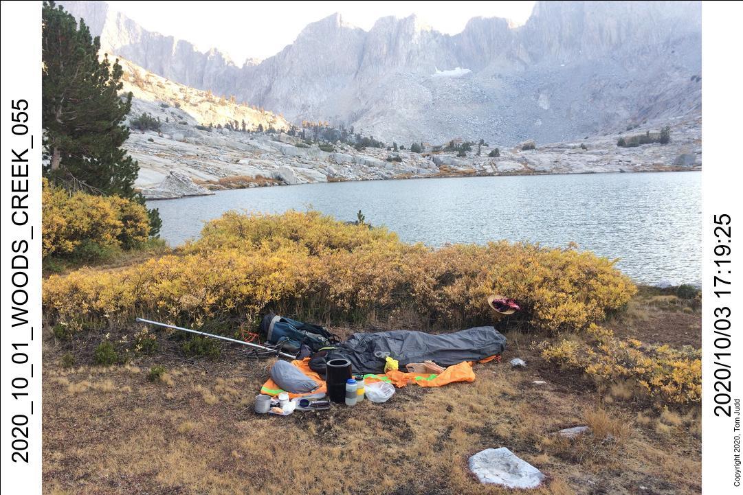
Oct 3, 2020
Up at 6, started hiking just before 8. There is another canyon I had hiked up in 2009 with Dale. I got to it about 8:20 and thought about doing it again. One can find Tom's Tumbler up that drainage. It was steeper, so I decided to go with King's Col drainage.
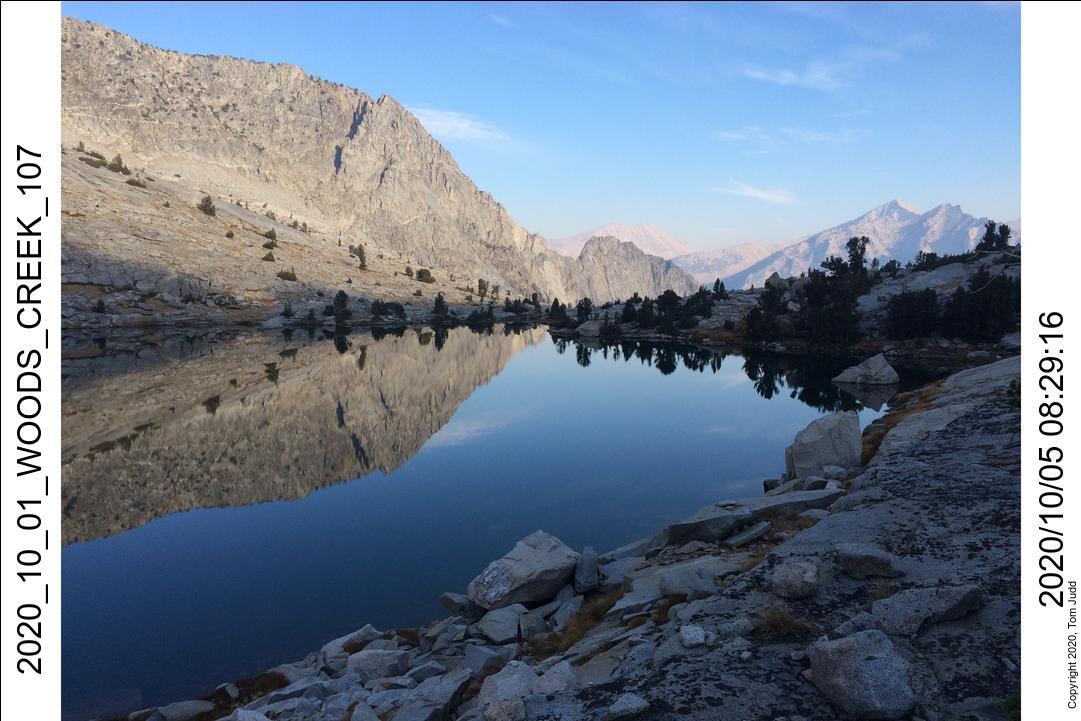
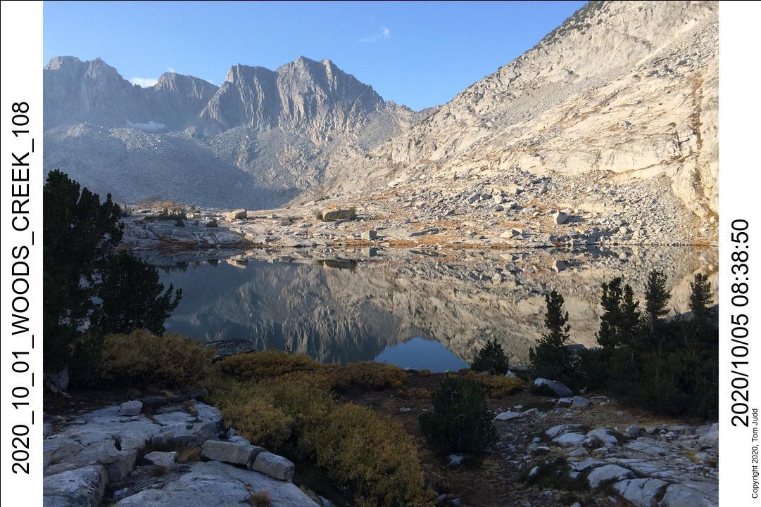
Got to the stream crossing point about 10:30. I looked and looked for dry rocks I could use, but the paths were always one rock short. I finally took my boots off, put on my sandals and waded across. I hate doing that because it takes so much time just to go 20 feet. Made it up to my campsite at the upper lakes at about 5 PM. The hike teased me a bit, there was always just one more lip to get to. A bit exasperating when I got there and found yet another. The afternoon breeze off the lake was chilly so I laid my sleeping bag down behind some low brush. I have been using my tent for a ground cover when I don't put it up.
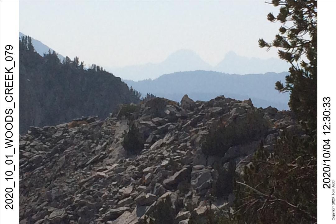
Oct 4, 2020
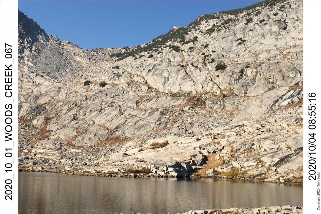
The plan is to climb the peak on the west side of the valley. I had been up to the peak twice before: in 2007 and in 2009. Each time I got hung up in some cliffy rocks when I came down. This time I was determined to get it right. On the way up, I made detailed notes. I would look back down and note the significant landmarks. It didn't do any good. I missed the trail again on the way down! Next time.
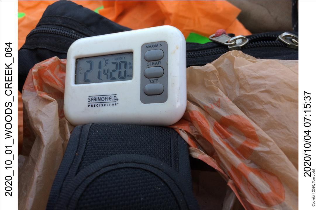
The temperature this morning was a surprise. I had checked the weather before the trip and expected temperatures slightly above freezing. It was 21.4 F (-6 C). I had placed my water bottles between my bivy and my sleeping bag. Both had ice in them. I had forgotten to protect my Sawyer water filter. A freeze can crack the membrane rendering the filtering useless. That's why I also take water pills.
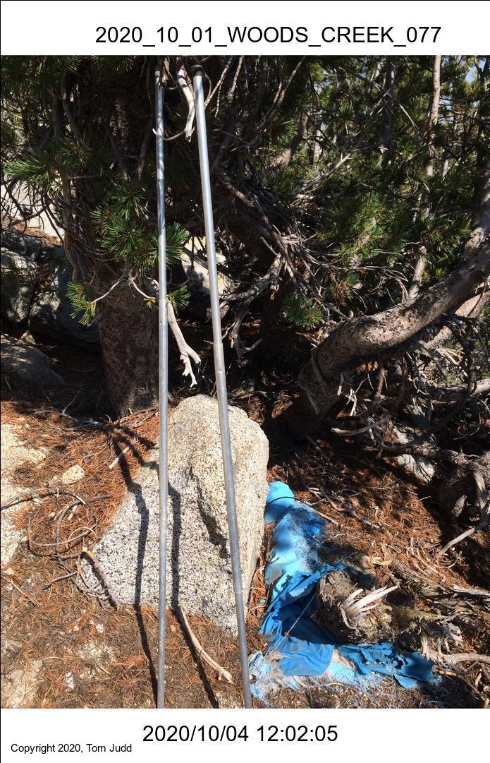
About noon I was up above the rocks and into the junipers. I came across the Lost Tent again. It is about 100 meters up from the south tip of the juniper grove. I had seen it once in 2007, and there it still was thirteen years later. It was like meeting an old friend. I unraveled the fabric and pulled out the poles. They come in three nesting aluminum pieces which fit together like they were new. I rewrapped them and left them for the next explorer to find and wonder who it was that lost the tent.
Got to the peak, took the pictures, and signed the log. No one else has signed it in the last eleven years. Started down about 2:30, and despite my detailed preparation, I missed a critical turn. Tried a couple of times, but finally decided I didn't want to go the cliffy route. When I was with Dale in 2009 he took a separate longer path to the right looping counter clockwise. Since it was getting late I chose the longer but more reliable path to the right. I didn't want to get cliffed in the dark. Down at my tent by 5:30.

Oct 5-6, 2020
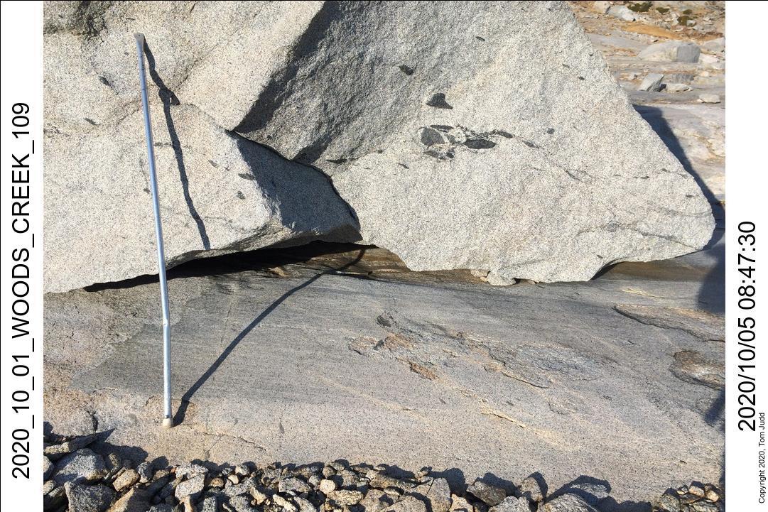
Next morning had a more reasonable low (34 F), but some ice had formed over some of the ponds. It was a nice hike in the morning down to Woods creek (downhill!). Again had to take off my boots to wade across. Instead of going back to the trailhead, I went uphill in order to get a look at the aftermath of an avalanche. I think it was around 2010 that an avalanche scraped clean a 25 yard path down the mountain. You can track it with Google Earth.
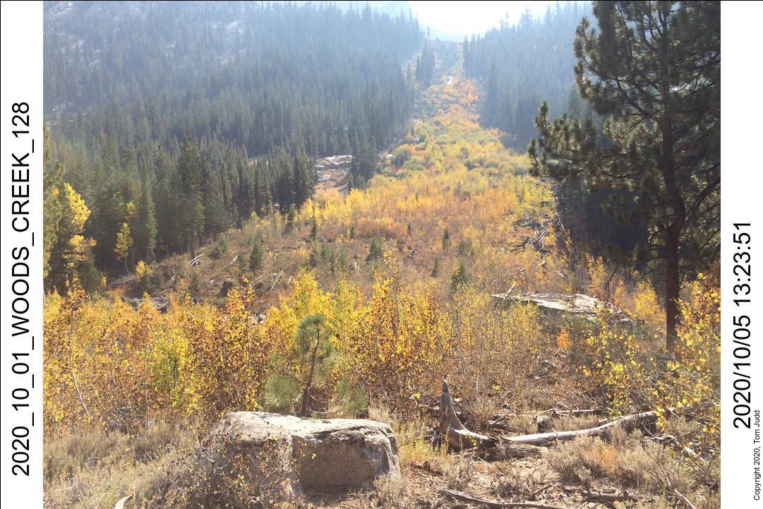
I turned around and headed downhill at about 1:30. Made it to Middle Paradise Valley campside by 5:30 where I spent the night.
I was up early on the last day for the race home. Started hiking about 6:30AM, was at the trailhead at 9:45, left Roads End a little after 10AM and got home abot 6:20 PM. Nice Hike.
©2022 Tom Judd
www.juddzone.com
Carlsbad, CA
USA